By Chris Martz | November 23, 2019
Good evening everyone!
Thanksgiving is less than a week away, so I decided that I wanted to give my viewers a heads up on what’s going on across the country this week as you make holiday travel plans.
Short-range: tonight, tomorrow, and Monday
There isn’t a whole lot to look at on the radar right now across the Lower 48.
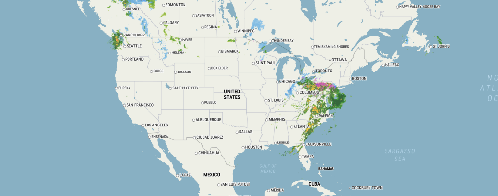
This is largely because there is a large area of high pressure over the Western U.S. which extends through a large depth of the atmosphere. This is called a ridge. Ridges are associated with sinking motion, which warms the air adiabatically and prevents convection.

There is a large storm rolling up the Eastern Seaboard this evening, as denoted by the surface low on the map above and on the Doppler Radar. Let’s look at this in more detail.
A large cold front is currently draped over the Southeast, stretching from the North Carolina / Virginia border down to the Gulf of Mexico, while some occlusion is occurring over the Mid-Atlantic. Our stationary front extends eastward from our cold front over North Carolina, separating the air masses.
Because cold air can’t hold much moisture, the cold front passage causes water vapor to condensate which forms clouds, eventually leading to precipitation.
Heavy rain bands have formed from Apalachicola, Florida to Charlotte, North Carolina to the Jersey Shore. Wrap-around rain showers have popped up across northwestern Alabama, Kentucky, western North Carolina, and southwestern Virginia.
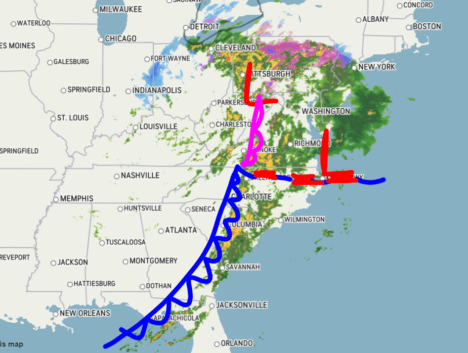
While this rain may cause some travel disruptions and delays across the East Coast, our major area of concern for the next couple of days is Pennsylvania, New York, and New England.
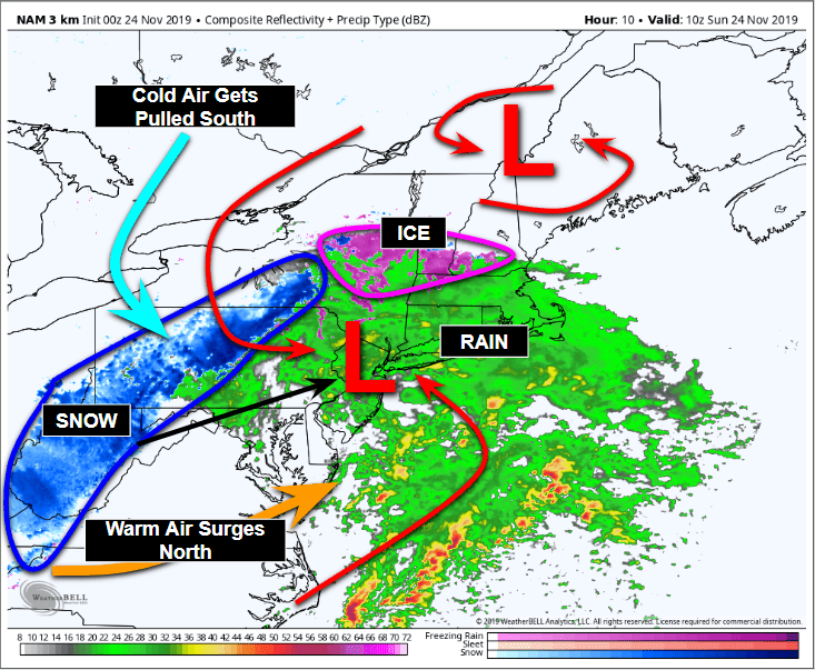
Current radar imagery shows that a large portion of the Allegheny and Pocono Mountains being nailed with quite a steady pounding of sleet, freezing rain, and wintry mix.
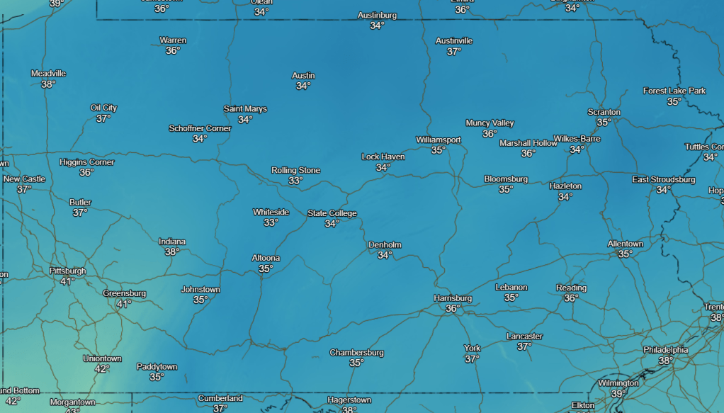
Current temperatures are hovering just above freezing, so while the lapse rate is enough with altitude to produce frozen precipitation, this warmth at the surface is a good indicator that there will be little to no accumulation of wintry precipitation, though some on grassy surfaces can not be ruled out.
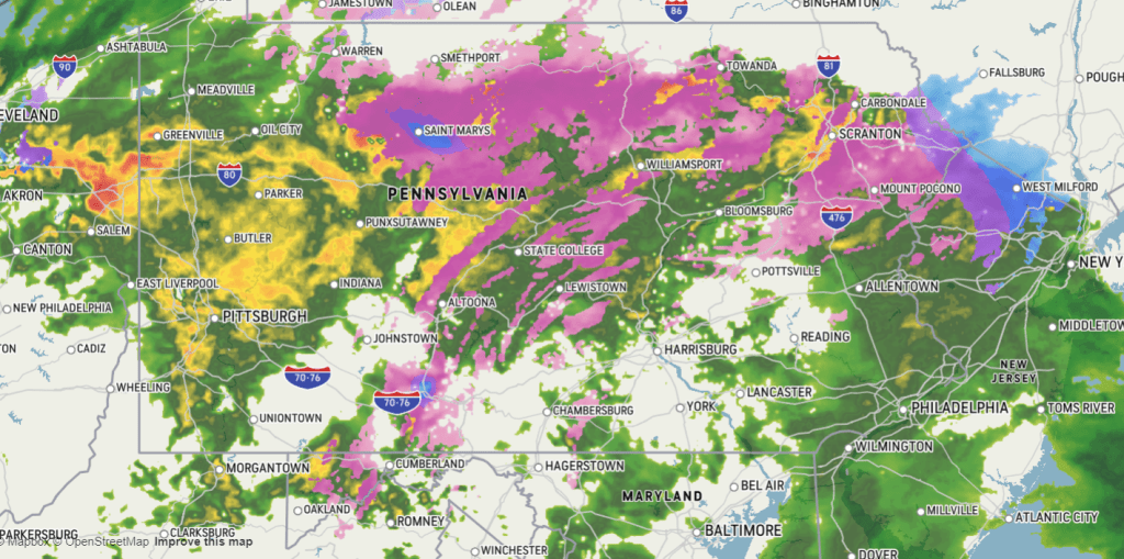
By six o’clock tomorrow morning (eastern time), our low will have slowly tracked east, northeast towards New Jersey overnight. Most of the heavy rain activity has now shifted north and east over the I-95 corridor from Baltimore, Maryland to New Jersey to New York City and then east into Connecticut, Rhode Island, and Massachusetts. At the same time given temperature profiles, it’s likely that icy conditions will ensue across the Adirondack Mountains while a steady snowfall band stretches from Charleston, West Virginia up towards Binghamton, New York as cold air is pulled southward due to low-level convergence with the parent surface low over New Jersey. Warmer air compared to the nearby surroundings will surge northward into DELMARVA.
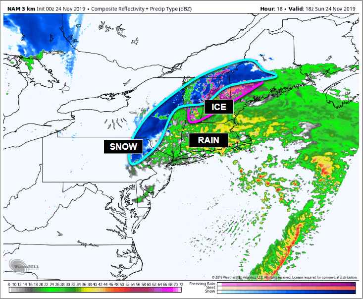
By noontime, the parent low looks to have moved offshore which has brought the precipitation focus over New England.
While I think the NAM is being a little aggressive with the snowfall rates (terminal velocity), I do think the area which it’s falling is a good simulation of what’s to occur less than 14 hours from now. Icy conditions, and hazardous travel are still expected to linger in the mountains at this time, though heavy rains will remain to the south from New York City to Boston.

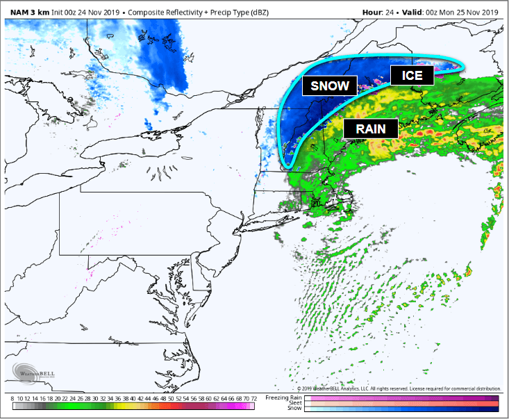
As our then coastal low tracks northeast well offshore, heavy (and I mean heavy) snow will begin to fall (outlined in light blue) well to the north of I-95 while sleet / freezing rain / wintry mix continues to fall as the elevated warm layer increases. This is for 6:00 p.m. E.T. tomorrow (Sunday) evening. While the rain may cause a few airport delays and travel disruptions, it should not pose a major threat at all. Some flooding is possible. Our biggest threat is the snowfall, especially across interior Vermont, New Hampshire, and Maine.
By midnight Monday morning, most of the East Coast is now dry with New England dealing with perhaps the worst of the storm because our pressure gradient increases, which intensifies the storm. Model output statistics have the minimum central pressure anywhere from 978 millibars (NAM 3 km) to 983 millibars (GFS operational).
Things will start to clear out by late Monday evening or early Tuesday morning.
So, how much snowfall am I expecting? Well, given temperature profiles and climatology, I think it’s safe to say that the National Weather Service‘s snowfall product from the NDFD is very realistic.
Expected snowfall totals through Tuesday morning:
• Allegheny Mountains, PA & WV: 0.5 to 3.0 inches (locally).
• The northern Poconos, PA: 1 to 3.0 inches.
• Adirondack Mountains, New York: 2.0 to 5.0 inches.
• Interior VT, NH, and ME (well north of I-95): 3.0 to 6.0 inches, locally up to 10.0 inches.

Medium-range: Wednesday and Thursday
While our Northeast storm system should be out of here by Tuesday morning, there are two other areas I am closely watching. Details are fuzzy for the time being, and thus I will have another blog update on this on Tuesday or Wednesday.
A small disturbance will form in the jet stream flow in western Canada and as it slides south and east into the Rocky Mountains slowly, but steadily over the next few days, it’ll greatly intensify potentially bringing major snowfall to the Great Plains and Upper Midwest, and maybe parts of far northern New England given model guidance. Exact timing, storm track, and overall details are unclear at this time.
Behind this system, a storm in the Pacific will slam into the West Coast of the United States on Wednesday which will likely bring heavy rain to the coastlines, lowlands, and valleys, not to mention very heavy snow to the Sierra Nevadas, Cascades, and Rockies between then and Thanksgiving. From there, it may become another major mid-latitude cyclone over the Heartland.
Categories: Weather

Leave a comment