I’ve been keeping a close eye on our next storm system brewing to our west this evening. It’s expected to come over into our region tomorrow and then impact New England on Sunday. Given that this is what we like to call an “Inland Cutter,” forecasting how much snow will fall is extremely difficult, and as a result, forecasts are usually overdone or underdone.
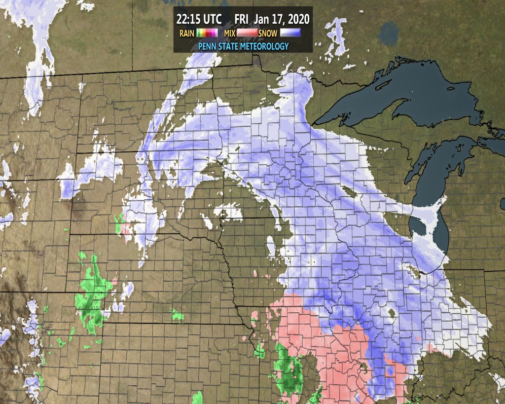
Current radar imagery shows some steady snow falling across much of Illinois, Minnesota, eastern Iowa, and western Wisconsin, with ice in Missouri.
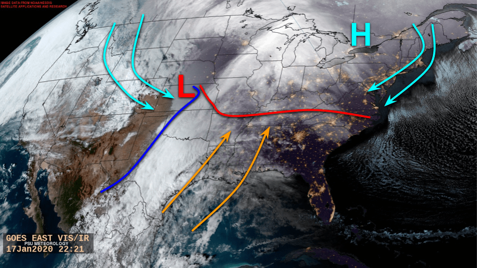
Many areas of rising motion have formed secondary lows, but the primary low (not labeled) is over Wyoming. The center of circulation appears to be over the Great Plains, but the storm is quite a mess, so it’s hard to tell. But, some basic features like frontal boundaries and high pressure can be noted. The warm front (red) extends east to west from southern Missouri to North Carolina while the cold front (dark blue) runs north to south from the convergence point down into Mexico. Cold air (light blue) is being pulled into the center from the western side, and warm, moist air (orange) is being advected in from the Gulf.
A stream of clouds have formed along the cold front, and north of the warm front is where wintry precipitation is currently falling. South of the red line, rain is falling. An Arctic surface high of 1,046 millibars can be found north of Lake Ontario which is driving, cold air southward from the north along the Appalachians. Thin, wispy cirrus clouds can be found to the east of the high. These clouds typically denote calm weather with a storm approaching from the west. And indeed, this bit of folklore holds true.
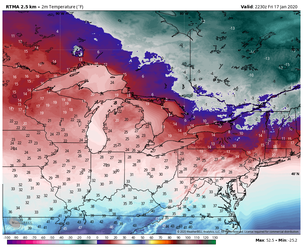
With the Arctic high in place, everyone north of the Carolinas will safely fall below freezing tonight, and in most cases, they already are at 6:00 p.m. E.T.
As our low tracks to the Northeast overnight, our warm front to the south will begin to lift to the north. As I will explain later, this warm front and just how fast it moves north (plus our low’s track) will play a crucial role in just how much snow and ice we’ll see versus the amount of rain.
Cold air will continue to infiltrate down from the Rockies and Plains on the back side of the storm, while at the same time, the Arctic high begins to shift southeast, which will eventually reverse the wind direction in the warm front’s favor. Because our low will deepen overnight, it’ll eat at and weaken the high pressure area forcing it to move. This has been the general setup all week.

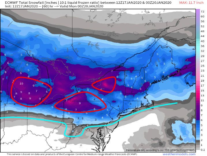
As far as snowfall accumulations go across the Corn Belt, the highest impacted areas will be north of I-80 and I-90. As a general rule here, expect 3 to 6 inches from North Dakota east to Wisconsin. Areas like Chicago and Fort Wayne will be a tough call; at best 1-3 inches, but it’s likely to be much more of an icing event.
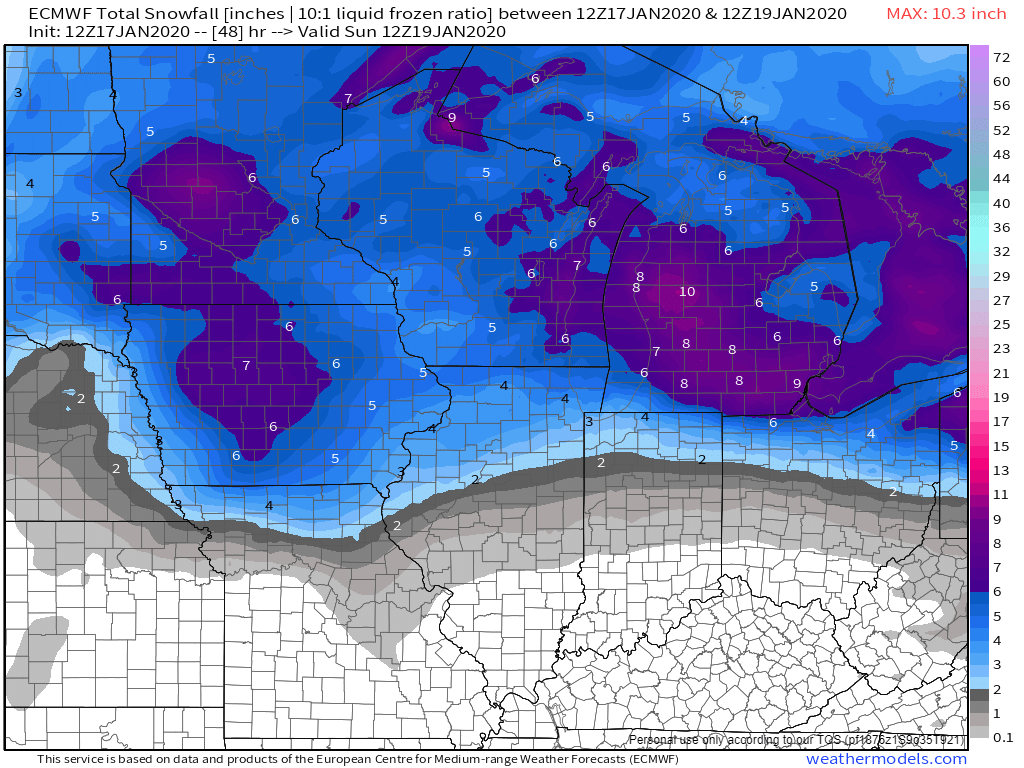
In the Upper Mid-Atlantic states as well as New England, I expect generally 4 to 8 inches. Higher amounts across Michigan and along the Lake Erie side of Pennsylvania and New York could see much higher amounts on the order of 8 to 12 inches due to lake-effect as cold air blows across. Areas at risk are circled in red. Much of this will fall tomorrow and into Sunday.
The biggest area of uncertainty is with the Washington, D.C. area. While I am expecting snowfall, I think this will be more of an icing and rain event. Temperatures overnight will fall with the high pressure area shoving cold air down along the mountains. As the precipitation shield begins to move into the region, I think we will see good snowfall during the early morning hours through about 8 or 10 a.m. E.T. Recent modeling suggests that there will be a lull in the precipitation which may allow the warm air to overrun the cold air aloft at first, then at the surface. IF that does happen to be the case, then the precipitation as the rest comes through in the afternoon and evening will be mainly rain. But, IF the lull does not occur, we could be looking at more ice.
Stay tuned into your local National Weather Service office for more specific details as the night progresses onward and during the day tomorrow.
Categories: Uncategorized

Leave a comment