By Chris Martz
Follow @ChrisMartzWX
We are now less than two months away from meteorological summer, and there is no sign of a locked-in spring for the Upper Midwest and Great Plains, as a late-season blizzard is set to drop a hammer late week.
On Monday, temperatures finally topped the 70s for the Heartland, and that is all about to change in less than 48 hours. The storm began today, but will have high impact through early Friday morning, producing a very wide and heavy band of snow stretching from the Rockies to Ontario and Quebec.
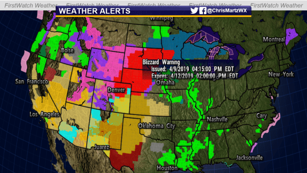
Nearly 10 million people are under winter weather alerts from the National Weather Service. Because of the potential for blizzard-like conditions, blizzard warnings have been issued for parts of Colorado, Kansas, Minnesota, Nebraska, and South Dakota.
Anywhere from 8 to 16 inches of snow is likely to fall from eastern Colorado and Wyoming to central South Dakota and central Nebraska. In central and eastern South Dakota, as well as western and parts of central Minnesota, anywhere from 16 to 24 inches of snow is probable. Eastern Nebraska and the Northwest corner of Iowa are likely going to see upwards of 3 to 6 inches before it’s all said and done. Areas like Northern Minnesota and northern Wisconsin will likely see less than 8 inches, although some areas are likely to receive 10.
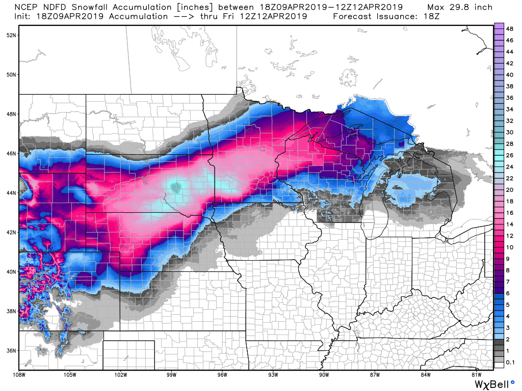
Most model output statistics (MOS) show a bullseye of 24 to 30+ inches of snow across parts of South Dakota.
This should be taken with a grain of salt – in fact, all of these snowfall totals should – because of the fact that the sun angle this time of year is quite high. This means that the precipitation falling will likely transition over to a wintry mix or rain during solar heating during daylight if snowfall intensity/rates are not steady enough (this applies to areas on the outer edges of the snow).
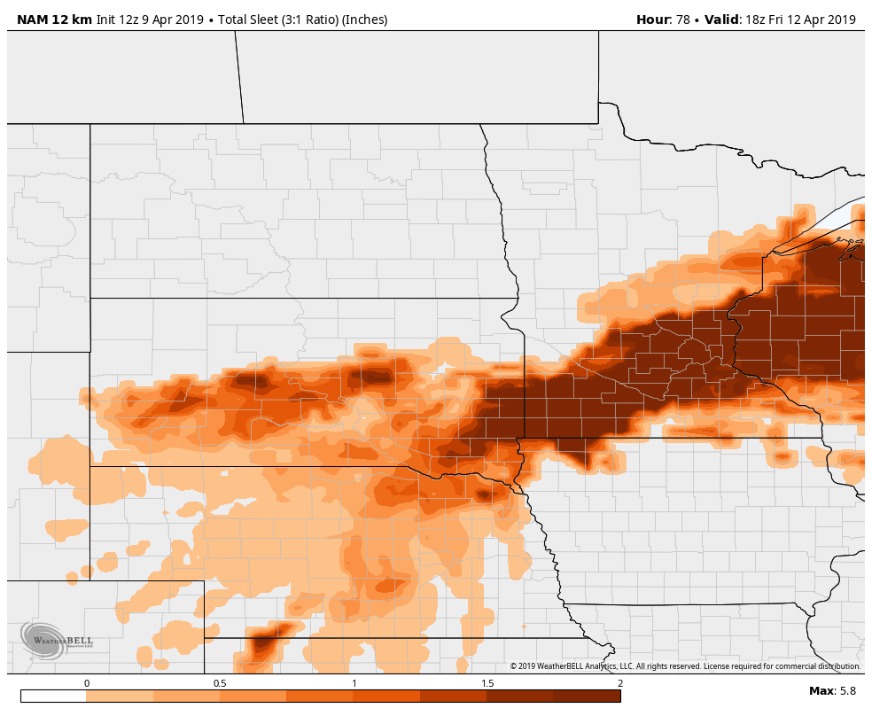
Temperatures will also play a role in this, as if warmer air gets pushed aloft colder air coming out of Canada, falling precipitation will likely pull down or mix warmer air to the surface, thereby changing snow to wintry precipitation or even rain. And indeed, MOS is showing incredible sleet totals across Minnesota and South Dakota, which is even worse for travelers than snow.
While the snow lovers like me will be missing out on the snowfall here in the D.C. area, it is important to remember that this storm system is the last thing that the Great Plains and Upper Midwest need, as they have been recovering from the “Bomb Cyclone” back in March; they are still trying to dry out enough in order for crop planting to begin.
Meanwhile, for us on the East Coast and for those south of the storm, steady rainfall is likely on Thursday and Friday depending upon where you live.
Whatever happens, happens, and there is nothing you can do about it! Between now and then, please travel safe, stay safe, and God bless! Remember, “all weather is good, it’s what you make of it!”
Categories: Weather

Leave a comment